


Coastal Planning Western Australia
Reading the draft State Coastal Planning Western Australia policy document it appears that the new policy for coastal planning in part seems to be based on some ‘convenient truths’ that support current government positions on coastal development.
Limits on Building Heights
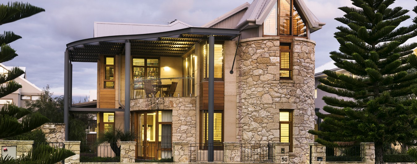
The first anomaly in the new draft policy document for coastal planning Western Australia, compared with the old document is the conditions covering “the maximum heights adjacent to coastal boundaries of 5-storey maximum. This limit to be less where community support for lower height is evident.’
This limit has disappeared from the new document, leaving the question of height completely open to interpretation.
Ambiguity Leads to Misinterpretation
The correct interpretation simply did not happen with Cottesloe Beach LPS3 proposed planning scheme. This omission to references to height limits appears to conveniently suit the current government’s stance.
Height Limits for Coastal Planning Western Australia
If credibility is to be achieved with this document height limits based on objective criteria must be clearly defined in scientific terms. The final writing of the Coastal Planning Western Australia policy document represents a unique chance to protect our coastal environments for generations and reflect great credit on the Barnett Government.
Use Sun Control Lines to Avoid Overshadowing
Apart from community sentiment and urban design principles which can often be seen as subjective, the only clear way to control heights is using sun control lines to help protect current and future beach alignments from overshadowing in the mornings.
Maximum Height Limits at Different Locations.
The use of the 8-storey maximum limit tied to community approvals is missing from the new draft policy document. Maybe this is a good thing.
My experience as a consultant and legal witness protecting Cottesloe Beach from inappropriate development has shown that ambiguity and subjective judgments simply add up to community warfare and contention, resulting in absolutely no certainty for developers.
Control Angle of 15 deg. Protects Key Amenity Locations
All heights should be tied to an overall control angle from the beach, and key social areas along the coast, and should be specified to prevent subjective judgments in the future.
See our January article Cottesloe Foreshore Plans on this site – illustrated with 3D drawings and photographs of the current and potential future Cottesloe coast line.
Formal recognition of Climate Change and rising ocean levels are major positive steps forward for the bureaucracy, considering the already long delays in action and ambivalence to the consequences and ramifications for coastal planning Western Australia.
Read more on the predictions for the world’s rising ocean levels: Ocean Level Rising
Minimum Set-Backs
Prior to the realization of ocean level rise due to Climate Change the minimum set-back was fixed at 78 to 98 metres from highest sea datum (‘HSD’) various types, based on a possible sea rise of 380 mm.
The current ocean level rise is now predicted to be at about 1 metre (or as accepted in Western Australia: 900mm) by the end of the century.
Questions still need to be asked why this set-back from HSD is now specified at only 90 metres. One would expect the set-back would be more than the previously specified 78-98 metres.
This draft policy clearly avoids any detail or scientific data to back up generalized comments and statements which effectively give the discretionary power back to the authority of the government of the day.
Overshadowing Clause is not Strong Enough
This amenity provision now clearly requires that the West Australian coastal foreshore be ‘not detrimentally affected’ by any significant overshadowing of the foreshore.
Although the consideration of overshadowing is justified the document the words ‘not significantly affected’, effectively leaves the door open for some level of overshadowing.
Overshadowing should be defined by the correct algorithms, key solar exposure/shade angles and incorporate verifiable times of use by visitors to the beach and public amenities along the coast that relate to such environmental considerations. This was clearly defined by the 2004 solar study for Cottesloe Beach.
Maximum Heights Clause Open to Manipulation
The maximum heights are no longer specified as they were in the previous Policy document. It now simply refers to the ‘desired character and amenity’ of the locality. This is purely subjective and open to manipulation by future governments and lobby groups.
Vulnerable Coastline Interpretation
There has been added a ‘vulnerable coastline area’ section in the draft document that allows a new designation to land titles considered at risk over the next 100 years.
Who actually decides what is a vulnerable coastline area will be interesting.
VIDEOS:
Click to view three 45 second videos comparing the coastline at Cottesloe Beach in the years 2011, 2030 and 2100:
Cotttesloe Beach Ocean Level in 2011
Cottesloe Beach Projected Ocean Level in year 2100
Cottesloe Beach Projected Ocean Level in year 2100
Consequences of Inaction
No action or late action will mean we are definitely going to be facing 7-10 metre seawalls by the end of the century, as shown in recent newspaper articles.
‘Huge, ugly sea walls’ will prevail, as they have in many other erosion locations around the world, where it was all left too late and ingress was denied.
Cost of Beach Stabilisation Methods
Beaches on The Gold Coast, Queensland, Australia, use artificial sand pumping and stabilization methods extensively all year round, to hold the beach in place. This is costing the community $35 a beach visit.
This cost would be much higher for Cottesloe Beach, notwithstanding the reduction of quality of the beach.
Coastal Hazards
The draft policy actually clearly states that development should be avoided where there is danger of coastal hazards. There are definite future hazards facing Cottesloe Beach.
40-metres Cross Erosion Allowance
This condition virtually wipes out most of Cottesloe Beach up to the current sand dunes if the beach alignment is worked out using this principle.
The use of 100 times the 100-year State estimated ocean level rise of 0.9 meters is a general figure and is a good guide at this time. But there is a need for some adaptability to scientific forecasts.
That figure puts at risk most properties along Marine Parade if there is no allowance for a buffer zone or reclamation reserve. This allowance applies in sandy coastlines, which with current ocean levels includes much of the Cottesloe Beach zone.
This regulation alone obviously eliminates the validity of having 5-storey development in key locations along the Marine Parade alignment, at Cottesloe.
Coastal Planning Western Australia Potential Solutions
My guess is that a hybrid solution of some sea walls will be in place at the end of the century but without our beach still looking pristine as it does now.
Some limited engineering may be needed to hold back erosion but it will need to be restricted in order to reduce costs and limit disturbance of the natural environment.
The beach must be allowed to move eastwards to calculated degree. Planners should allow for this in planning schemes.
To date the public interest has not been handled well by all parties. Hopefully with proper focus on this draft coastal planning Western Australia policy document, much can be redefined to create developer certainty that is in the long-term public interest.